Laser distance measurement technology uses the characteristics of laser beams to achieve high-precision distance measurement and positioning. The following is a detailed introduction to several major laser distance measuring tools:
1. Laser navigator
Laser navigator is a high-precision navigation tool, mainly used in:
– Military: used for navigation, target positioning and terrain mapping, helping the military to accurately locate and strategic planning.
– Aerospace: Provides accurate positioning data in satellite launch, aircraft navigation and space exploration.
– Maritime: Used for ship positioning and navigation to ensure safe and accurate navigation.
2. Laser distance meter
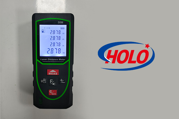
Laser distance meter is a commonly used precision distance measurement tool with the following characteristics:
– Measuring distance: By reflecting the laser back to the receiver, the distance between objects can be accurately measured.
– Angle measurement: Some high-end laser distance meters also have the function of measuring angles, which can be used for three-dimensional positioning and angle adjustment.
– Widely used: Commonly used in fields such as building measurement, engineering survey and interior design.
3. LiDAR
LiDAR technology obtains detailed data of the target through laser scanning, and has the following advantages:
– High-precision height and distance measurement: It can provide very accurate elevation and distance data, and is widely used in terrain mapping and environmental monitoring.
– Target identification: Through laser reflection and scanning, the three-dimensional data of the target can be obtained for detailed analysis and modeling.
4. Laser spectrometer
Laser spectrometer uses laser spectroscopy technology to provide accurate spectral data, which is often used for:
– Spectral analysis: Measuring the spectral characteristics of a substance to determine its composition and properties.
– Positioning and ranging: Based on spectral analysis, high-precision ranging and positioning can also be achieved.
5. Laser gyroscope
Laser gyroscope uses laser gyroscope technology to measure the rotation and angle change of an object, and is suitable for:
– Inertial navigation: It is used to provide accurate attitude and motion data, and is widely used in aerospace and military fields.
– Positioning and navigation: After combining with other sensor data, high-precision positioning and navigation can be achieved.
These various laser distance measuring tools have their own characteristics and play an important role in different fields. By combining these laser technologies, more accurate measurement, positioning and navigation can be achieved, improving the efficiency and accuracy of various applications.